The main source of water for drinking and agriculture for most of the residents of Terai in Province 2 is underground water. For all these activities, people pump water from the ground through boring and hand pumps to meet their necessities. Around twenty years ago, such water could be pumped from around 17-18 meters deep in Jirabhawani Rural Municipality ward 5 and its nearby places in Parsa district. But nowadays, water is hardly found even after the pipe is inserted around hundred meters into the ground. This state of affairs is not only prevalent in Parsa district but in the entire Province 2. This suggests that the source of underground water is depleting slowly. The difficulty in accessing the water is making the daily life of locals painful. At the moment, residents of Province 2 in districts including Parsa, Bara, Dhanusha, Mahottari, Siraha and Sarlahi are facing water crisis. The destruction of Chure has turned hundreds of hectors of cultivable land into sand bank in Parsa district. Hundreds of hectors of cultivable land in Jirabhawani Rural Municipality in Parsa district situated alongside Oriya River have turned into sand bank.
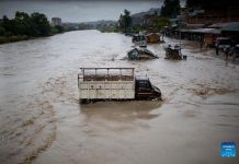
 The land where rice, wheat, mustard and other crops were cultivated have been converted to sand bank due to natural disasters that occurred two years ago, according to the farmers. Dhanraj Chaudhari, a farmer of Jirabhawani Rural Municipality – 1, Mahadevpati, said he has a couple of hectors of arable land where he used to cultivate rice, wheat, mustard, and lentil, but the flood occurring every two year turned his them into sand. Chaudhari said the flood washed up sand all over his fields. Although he had never imagined that the area would be flooded, all of the cultivable land has been converted to desert. He says the level of water in that river, as compared to the past, is not sufficient to provide water to other agricultural activities.
Similarly, another farmer of Mahadevpati Manmohan Mahato says that his six hectors of cultivable land has been converted into sand bank. In the past, he grew rice, wheat and lentils in his land, and he didn’t have to go to the market to get them. However, with the conversion of cultivable land to sand bank, he said that he has to depend on the market for rice, wheat and lentils. The flood in the river that occurred two years ago caused the river to change its course, which in turn caused his six hectors of land to be converted to sand bank, he said. He further stated that more than fifty hectors of land in Mahadevpati have been turned into sand bank. The river, which used to flow as a stream, has been widened to two to three hundred meters due to the flood that occurred two years ago.
Likewise, another farmer Dukhaa Mahato (literal meaning of his name being ‘sorrow’) is indeed in sorrow because of the flood that occurred two years ago. Five years ago, the river was far away from the village, but now it has come nearer to the village, and because of that, the land used for agriculture and kitchen gardening has turned into desert, said Mahato. It was time of paddy harvesting when the inundation happened. As the flooding caused the river to flow nearby the village by eroding the cultivable land, Mahato said that he has been working as a daily wage earner for Nepali Rupees six hundred. His eyes are full of tears as he remembers that there used to be days when there was a granary for rice and wheat in front of his home. Farmer Dukhaa explains that he has to make his living on daily wages because all of his cultivable land has now turned into piles of sand.
 Farmers are facing various troubles, as the Laate Gaad River has seen no water for the past twelve years. Resident of Jirabhawani Rural Municipality Ward 1, Shanti Nagar Ravi Mohan Sapkota says that deforestation, haphazard mining of stones and sand, and overexploitation of forest resources have caused the lack of water in river; the water flows in the river sometimes during monsoon season. The cultivable land is buried by the stream and sometimes the flood causes the settlements to be displaced, he said. Moreover, he said that deep borings are drying as well. Although it did not use to be like this, the deep boring has been drying since 10 -12 years, he informed. Sapkota also explained that 20-25 deep borings, which used to irrigate 100-150 hectors of land, have now dried.
Drinking Water Scarcity and Drying of Boring and Hand Pumps
Water sources have started drying in half a dozen villages in northern rural areas of Parsa district. A resident of Thori Rural Municipality ward 5, Som Maya Magar told that the hand pumps in the villages have not been providing water for the last 5-7 years. The locals are worried not only for drinking water but also for irrigation purposes. They remember how easy their life was earlier because of the water resources. The various water resources used to be the pipeline connected with the water sources in the forest, canal and hand pumps. Although there are several taps, none of them provides water. Many hand pumps have stopped providing water as well. Magar said that they are surprised that the water was not available even after drilling for seventy-two meters deep, as there used to be enough water after boring for just 16-17 meters back in the days.
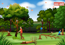
Rewati Ghimire of Jirabhawani – 5, Pahadi Tol (meaning area of people from hilly region), Haraiya, said that the taps providing drinking water have been drying. In around 1993, water was easily accessible at 16-17 feet. After seven or eight years, the water was not available. He said that they inserted pipe to 25-30 feet at the same spot to get water. Moreover, that one dried up as well after another five-seven years. Again, they inserted pipe to around 50-60 feet at the same spot and reached water. Now that one of them has dried up as well, he said. Ghimire claims that there was dense forest in the past, but now the forest has been destructed, which has caused the drying of water. He says that the water they are drinking now is not of the same quality as before, but he explains that they are forced to drink that water. The natural cause due to destruction of forest every day is the reason behind drying of water, he said. Around fifty households living in Haraiya are now facing this problem, according to him.
There used to be a hand pump at every house, but now, none of the houses has hand pumps, said Sunita Budhathoki, a resident of Thori Rural Municipality ward 5. She said that everyone has taken out the hand pumps at their houses as they have dried up. It was easier for everyone to get drinking water as they had hand pumps at their houses, but it is harder now as no one has a hand pump at their house, she said. She further says that this problem has been existing for around sixteen years now. She said that none of the houses has hand pumps and they rely on rainwater. She also said that there is lesser rainfall during monsoon season as well. She believes that the forest destruction and lack of Chure conservation have caused all of these problems.
Bhim Bahadur Pakhrin, a resident of Thori Rural Municipality ward no. 5, Suvarnapur, says that drying of water sources in the area has been caused by forest destruction, leading to water scarcity. He says that measures should be applied to conserve plants and natural resources. Everyone should pay attention to make sure that the southern part of Parsa National Park, the Indian area, is not turned to desert in the future, he added. He said that to save fertile soil and preserve this land from turning into desert in the future, it is necessary that all smugglers of forest resources should be stopped and forest areas must be conserved.
Journalist and Analyst Chandra Kishor Jha said that Chure-Bhawar area, which is waiting for conservation, should be conserved through President Chure Conservation Programme conducted by Government of Nepal along with public engagement and committee of experts.
Senior Journalist Jha said that there was feeling that the forests would be conserved after the introduction of federalism, but that didn’t happen. It was thought that the overexploitation of Chure would be stopped and it would be conserved after the election of representatives for federal, provincial and local levels, but there has been no effort, and as a result, Chure suffer further destruction, he said. He says the Terai region, which is known as granary of Nepal, will be turned into desert if the destruction of Chure region is not stopped. He says Terai will be converted into desert in the next ten years if the exploitation continues. He says if that happens, then federal, provincial and local government should assume the responsibility for that. He explains that there has been decrease in water level and rise in amount of sand in Terai region. He also said that there is decrease in productivity as the fertile soil used for rice cultivation is now covered with sand. He said that they could observe the effects caused by Chure through naked eyes. He said that the Maule River in Dhanusha district is now drying and the wells in the area have dried.
It is important to take necessary actions that could be done immediately to conserve resources such as forests, river, streams and sand of the Chure region and to strengthen the hill and land of this area. It is also necessary to adopt long-term measures and make mandatory rule for planting trees that can increase the hold of sand and soil in the public lands in Chure region as well as prepare a separate committee to conserve the land.
Yadav said that overexploitation of Chure region has caused the level of river in southern part to increase by 25 to 30 centimeter every year as the soil of Chure region is deposited there, and the water sources are drying as well as the water level is deepening. “The level of rivers in the Terai is increasing due to soil erosion in Chure region. The risk of flood in settlement and the cultivable land is ever increasing,” Yadav said, “with the destruction of Chure region—the major factor for recharging underground water—the water sources are drying.” He also said the Chure hills are being destroyed due to haphazard road construction without environmental impact assessment.
The experts say, if the haphazard running of dozers and excavators in Chure region without comprehensive study for road construction, and the mining of stone, sand, wood and timber is not stopped, Terai region will face desertification and ultimately the nation will suffer a huge impact. Yadav said, “Resources should be extracted in an environment-friendly manner and without any impact on conservation of water sources. But the haphazard excavation seems to have been going on for years.” Land Conservation Officer Yadav explains that the lack of coordination between development offices and Office for Forest and Environment and Land Conservation has contributed in Chure destruction.
Assistant Forest Officer cum Information Officer in the planning section of President Chure Conservation Terai Development Committee Roshan Kumar Srivastav said that the Chure conservation campaign was launched with the slogan of “Chure ko maato Chure lai, safa pani sabai lai,” meaning, soil of Chure to itself, and clean water to all. Officer Srivastav says the work is being done with the objective of keeping Chure’s soil in Chure itself and saving Terai area from desertification. He informs that Khado River in Saptari District and Balaan River in Siraha District of Province 2 have suffered considerable damage, and budget has been allocated and work is in progress. He says that Chure region’s conservation has not been successful because of the residents of that area. He says the settlements in Chure region and random construction of roads are causing destruction of Chure. He claims the Terai region will turn into desert in the future if the Chure is not conserved. He says the smuggling of woods must be stopped and Chure should be saved from destruction by conserving the forest. He also says the lack of conservation of Chure will decrease the fertility of soil of Terai region and it will turn out to be full of sand.
According to statistics of President Chure Terai Conservation Terai Development Committee, 10922 households live in the Chure region. Situated at 60 metres to 659 metres above sea level, Chure region extends about 38 kilometers, from Banke River in the East to Bagmati River in the West. In this area, the Sonvarsha of Paterwa Sugaula Rural Municipality, and Sakar Saraiya, Sedhawa and Jagarnathpur of Jirabhavani Rural Municipality situated in northern part of Parsa district are facing a serious crisis of drinking water as well as water for agricultural purposes.
President Terai-Madhesh Chure Conservation Committee has planned to conduct programme through 92 local governments situated in the river system associated with Chure region. Programme Officer at President Terai-Madhesh Chure Conservation Committee Roshan Srivastav informed that, out of NRs. 1,462,625,000 allocated for the campaign in the current fiscal year, NRs. 1,420,225,000 will be distributed to 92 local levels, and NRs. 42,400,000 will be distributed to forest ministry of all seven provinces.


