Rapti River Basin – Introduction
- Basin area: 06 km2.
- District coverage: Mid-Western Region: 6 Districts (Dang, Salyan, Rukum, Rolpa, Pyuthan and Banke) and Western Region: 4 Districts (Kapilvastu, Arghakhanchi, Baglung and Gulmi)
- Watersheds: 11 (Lower Rapti/189, Upper Rapti/190, Middle Rapti/192, Rapti Pari/193, West Rapti/223, Siban Khola/364, Lundri Khola/372, Jhimrukh Khola/373, Madi Khola/380, Rapti/382, Arjun Khola/379.
- Banke National Park: Bardiya and Dang
- One Corridor: Kamdi Corridor (Banke, Dang, Kapilvastu)
- One protection forest (Initiation): Gaumukhi Protection Forest, Pyuthan
- One Hydropower: Jhimruk Hydropower (12 MW), Pyuthan
- Two Irrigation Dam: Sikta Irrigation and Laxmanpur Bandh (Banke)
- 2 Paani priority watersheds: Jhimruk Khola Watershed (373) and Middle Rapti Watershed (192)
Jhimruk Khola Watershed Key Facts
- River Basin: Rapti River Basin
- Province: Number 5
- Watershed area: 680 Sq. km
- Number of streams: 169
- Major rivers: Jhimruk Khola, Lung Khola, Gartang Khola, Chhape Khola, Jumri Khola, Jhakrithan kholka
- Lakes/wetlands: Jamune Daha, Barah Lake, Bijuwar wetland (Bhauka but now disappeared)
- Land use: 68% forest; 23% shrub-forest mix; 15% cultivation; 12% grazing
- Municipalities: Airawati, Gaumukhi, Jhimruk, Mallarani, Naubahini, Pyuthan and part of Mandabi and Saruma Rani
- Population: 145,005 (Male 63,743 and Female 81,262)
- Federation: FEDWASUN
Major progress update
- Entry MSC
- Training to citizen scientist
- Focal group discussion
- Key Informant Interview
- Biophysical survey
- Household survey: 3479 respondent (Biodiversity CC, Livelihoods, Drying water source, Water quality/availability)
- Fish non fish survey
- Exit MSC
- Road inventory with GPS device
- Supplementary workshop
- Draft Watershed profile and Watershed health report preparation
Issues
Key Issues
- Unmanaged local road construction
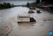
- Flooding, river cutting and submerging
- Decrease in water sources
- Decrease in water quality and water pollution
- Decline in fish stocks
- Riverbed mining
- Water use conflict
- Landslides
Focused Issues
- Decrease in water sources
- Decline in fish stocks
- Water use conflict
Middle Rapti Watershed Key Facts
- River Basin: Rapti River Basin
- Province: Number 5
- Watershed area: 454 Sq. km
- Number of streams: 47
- Major rivers, lakes: Rapti River, Arjun Khola, Khabhari Khola, Urung Khola, Supaila khola, Dolai Khola, Kakrahawa Khola, Sikrahawa Khola, Narti Khola, Kaudiya Khola, Arnahawa Khola
- Land use: 28% forest; 29.71% cultivation; 8.25% rivers; .42% urban area; 31% grazing, 0.02 ponds/lakes.
- Municipalities: Lamahi Municipality
- Rural Municipalities: Rapti, Gadhawa and Rajpur (Partial ward no 1,2)
- Population: 122,313
- Federation: NEFIN
Issues
Key Issues
- Flooding, river cutting and sedimentation
- Drought and drying up of water sources
- Forest degradation and forest fires
- Destructive fishing practices
- Wildlife poaching and illegal felling
- Riverbed mining
- Decrease in water quality and increase in water pollution
Focused Issues
- Flooding, river cutting and sedimentation
- Drought and drying up of water sources
- Destructive fishing practices


